
Airborne LiDAR – Precision Mapping from the Sky
All About Airborne LiDAR
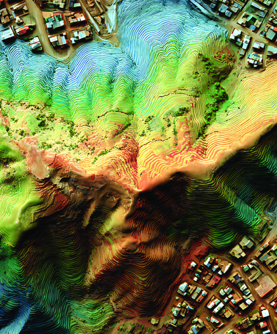
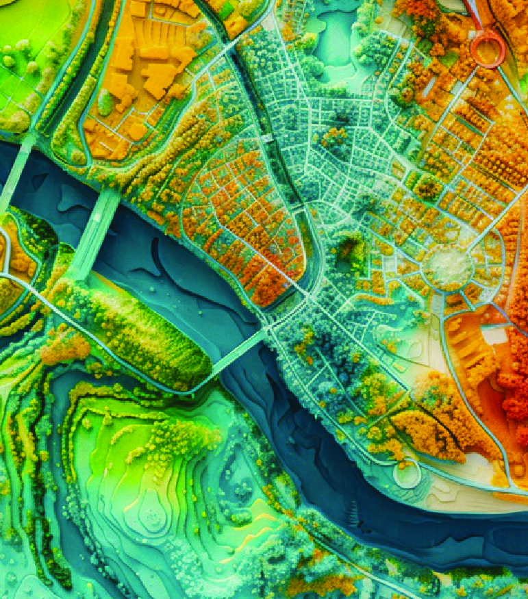
Airborne LiDAR is one of the most advanced techniques in geospatial data collection. Using helicopters, airplanes, or drones, Naksha Tech’s LiDAR systems scan the ground surface with laser pulses to generate dense, high-resolution point clouds. These datasets are then processed into Digital Terrain Models (DTM), Digital Elevation Models (DEM), and 3D maps.
Unlike traditional survey methods, Airborne LiDAR offers:
- Faster coverage of large and inaccessible areas
- Ability to penetrate vegetation and detect ground levels
- High positional and vertical accuracy suitable for engineering-grade analysis
At Naksha Tech, we combine Airborne LiDAR with AI and GIS integration to not only capture data but also help clients interpret patterns, detect anomalies, and predict outcomes. Our approach ensures that your projects are built on the most reliable geospatial intelligence available.
Turn Complex Terrain into Clear Insights
How is Airborne LiDAR Used?
Airborne LiDAR supports a wide range of industries and applications:
Create precise elevation models for construction, road design, and land-use planning.
Survey long stretches of railways, highways, pipelines, and transmission lines with consistent accuracy.
Analyze forest canopies, calculate biomass, and study ecosystem changes.
Model water flow, flood zones, and drainage networks with fine detail.
Assess terrain stability, calculate stockpile volumes, and monitor excavation progress over time.
Airborne LiDAR in Action

Who Uses Airborne LiDAR?
Government & Policy Makers
For urban planning, land management, and infrastructure approvals.
Infrastructure Developers
To design and monitor roads, railways, bridges, and power corridors.
Environmental Agencies
For watershed mapping, flood modeling, and forest conservation.
Mining & Oil & Gas Companies
For volumetric analysis and terrain feasibility studies.
Utilities & Telecom Providers
To optimize tower placements, transmission lines, and utility corridors.
How Does Airborne LiDAR Work?
Data Capture
Signal Return
Point Cloud Generation
Processing & Modeling
Integration & Delivery
Client Segments
Government Agencies
Land administration, cadastral surveys, and policy planning.
Infrastructure Firms
Roads, railways, airports, and corridor development.
Energy & Utilities
Power lines, pipelines, and renewable energy projects.
Environmental Management Bodies
Ecosystem mapping, disaster preparedness, and restoration projects.
Mining & Industrial Enterprises
Feasibility assessments, safety audits, and site planning.
What Makes Naksha Tech Different?
Comprehensive Expertise
We deliver the full workflow: aerial surveys, LiDAR capture, processing, and analytics.
AI & ML Integration
Automated classification, change detection, and predictive modeling for smarter insights.
Unmatched Scalability
From local projects to corridors spanning hundreds of kilometers.
Data Security Guaranteed
ISO 27001:2022 certified with encrypted workflows to protect sensitive client data.
Global Experience
Over a decade of experience serving 300+ clients in 90+ countries.
Proven Results
Faster surveys, higher accuracy, and reduced project costs for our clients.
Contact Us
We value you & your time. Please help us by submitting the form to serve you at a faster pace.
Frequently Asked Questions
Naksha Tech’s Airborne LiDAR delivers centimeter-level accuracy, making it suitable for high-precision engineering and planning projects.
Yes, LiDAR pulses can penetrate vegetation, providing accurate ground elevation data even under dense canopies.
It captures large areas quickly and eliminates many on-ground challenges, reducing survey timelines by up to 60%.
You’ll get point clouds, DEMs, DTMs, contour maps, and orthophotos—ready to use in CAD, BIM, and GIS platforms.
Absolutely. We provide BIM-ready and GIS-compatible outputs that plug seamlessly into existing workflows.
Yes, depending on the region. Naksha Tech handles compliance and ensures that all operations meet regulatory requirements.
Contact Us
Please get in touch with us. We are happy to help you.
Website
Sales & Marketing Desk
HR & Recruitment
Address
#73/1A, R.K. Chambers, 5th Main,
Chamarajpet, Bangalore – 560018, India
Leverage the Power of the Skies with Nakshatech’s Airborne LiDAR – Get Started Today
Contact Us
#73/1A, R.K. Chambers, 5th Main,
Chamarajpet, Bangalore – 560018, India
Leverage the Power of the Skies with Nakshatech’s Airborne LiDAR – Get Started Today