“Shaping the Future of Infrastructure with Scan to BIM & Geospatial Intelligence powered by AI, ML & Drone Innovation”
Years of industry Expertise

Delivered

Who We Are
We are pioneers in Geospatial and Engineering Solutions, dedicated to unlocking the full potential of spatial data. With over a decade of expertise and cutting-edge technology, Naksha Tech empowers governments, enterprises, and infrastructure leaders to execute projects with precision and speed.
Our GIS-enabled remote sensing technologies have helped hundreds of clients across industries achieve smart, sustainable, and cost-efficient outcomes—on time and with absolute reliability.

Our Expertise
With deep knowledge in GIS, LiDAR, photogrammetry, and mobile mapping, we deliver precise, reliable, and scalable geospatial solutions tailored to the needs of diverse industries.
Our Identity
Naksha Tech stands as a trusted partner in geospatial and engineering innovation, empowering industries to harness the power of location intelligence for smarter, sustainable projects.
Our Impact
Who We Are
We are pioneers in Geospatial and Engineering Solutions, committed to unlocking the full potential of spatial data. With a decade of expertise and cutting-edge technologies, Nakshatech has empowered governments, enterprises, and infrastructure leaders to execute projects with precision and speed.
Our GIS-enabled remote sensing technologies have helped hundreds of clients across industries deliver smart, sustainable, and cost-efficient outcomes—on time and with absolute reliability.
Who We Are
Our Expertise
Our Identity
Our Impact
Our Process
We follow a proven 6-step workflow that ensures accuracy, transparency, and results:
Pre-Analysis Survey
Survey Execution
Field data collection using aerial systems, DGPS, laser scanners, LiDAR, and photogrammetry sensors.
Data Processing
Converting raw data into clean, structured formats.
Client Approval
Feature Collection
Delivery
“From survey to insights – Naksha Tech delivers precision at every step.”
Our Process
Pre-Analysis Survey
Survey Execution
Data Processing
Converting raw data into clean, structured formats.
Client Approval
Feature Collection
Delivery
“From survey to insights – Naksha Tech delivers precision at every step.”
What We Do
Scan to BIM
Naksha Tech’s Scan to BIM service transforms physical spaces into accurate 3D digital models using LiDAR and photogrammetry, enabling precise documentation, efficient renovation planning, and better coordination between design and construction teams.
Geospatial Survey
Geospatial Mapping
Geospatial Software Development
Design & Engineering
Geospatial AI & ML
AI-Enhanced Geospatial Processing
Cloud-Powered Data Delivery
Access processed geospatial data securely, anywhere, anytime.
Digital Twins for Asset Management
Innovations & Breakthroughs
Innovation is at the core of Naksha Tech. We are continuously pushing boundaries to make geospatial data smarter and more accessible
SLAM-Powered Mobile Mapping
Sustainability-Driven Solutions
Drone Manufacturing Excellence
Innovations & Breakthroughs
Innovation is at the core of Naksha Tech. We are continuously pushing boundaries to make geospatial data smarter and more accessible
AI-Enhanced Geospatial Processing
Digital Twins for Asset Management
Creating real-time, interactive replicas of infrastructure for smarter monitoring.
Cloud-Powered Data Delivery
Access processed geospatial data securely, anywhere, anytime.
SLAM-Powered Mobile Mapping
Mapping dense urban corridors and GPS-denied environments with unmatched accuracy.Automating classification, detection, and modeling to deliver predictive insights.
Sustainability-Driven Solutions
Drone Manufacturing Excellence
Projects We Delivered
River Corridor Mapping for Clean Ganga Mission

Drone Mapping • River Monitoring • Geospatial Data
NMCG, Ministry of Jal Shakti • Yamuna & Sahibi Rivers • 65 sq. km • 2026
High-resolution drone photogrammetry and geo-tagged video mapping using DGCA-approved drones and DGPS Ground Control Points, generating orthomosaic imagery, DEM, DSM, 3D point cloud data, and GIS-ready datasets for river monitoring and rejuvenation planning.
National Highway Infrastructure Monitoring
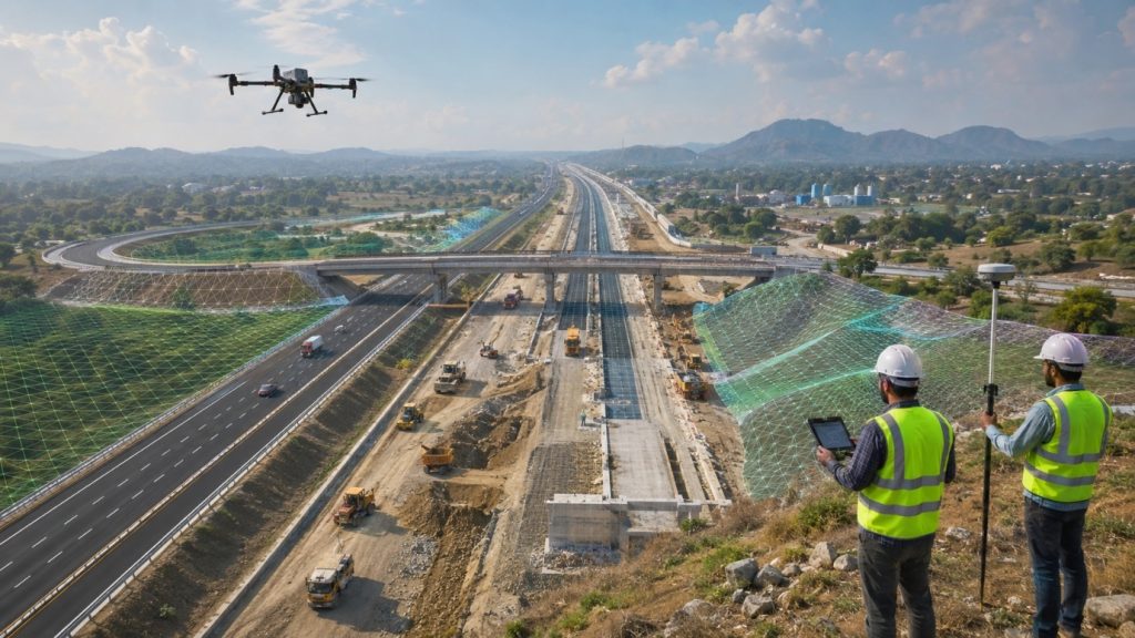
Highway Survey · Drone · GIS
NHAI, Ministry of Road Transport & Highways · NH Zone 7, India · 2025
High-resolution UAV imagery supporting DPR, construction monitoring, and O&M — orthophotos, 3D mesh, DEM/DSM, topographic features, and GIS-ready SHP datasets for highway assets.
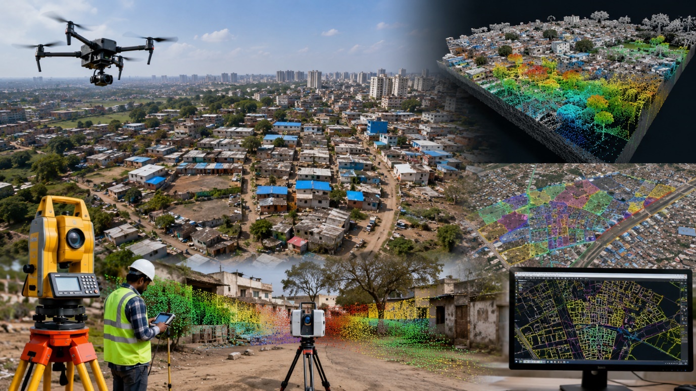
Slum Boundary & Topographical Survey

Urban Mapping · Drone Survey · GIS
Karnataka Slum Development Board · 13 districts, Karnataka · 6,894 acres · 2023
A multi-sensor survey combining drone, Total Station, LiDAR, and terrestrial laser scanning to map boundaries, households, and civic amenities across 6,894 acres — True ORI, 3D mesh, GIS shapefiles, and KMZ/KML.
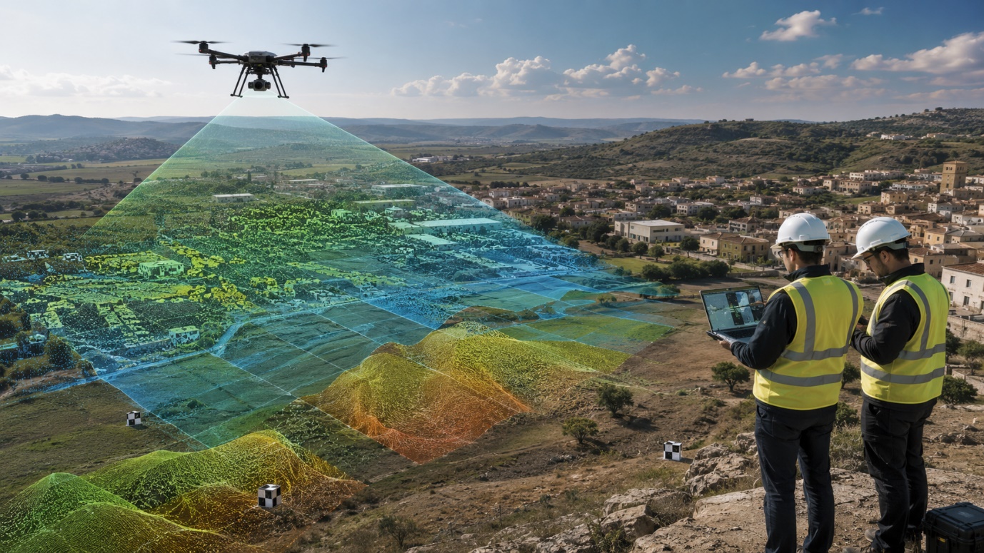
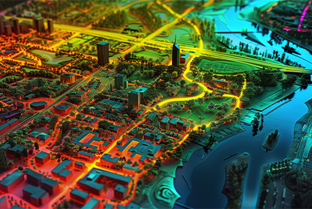
Smart City Mapping & 3D Visualization
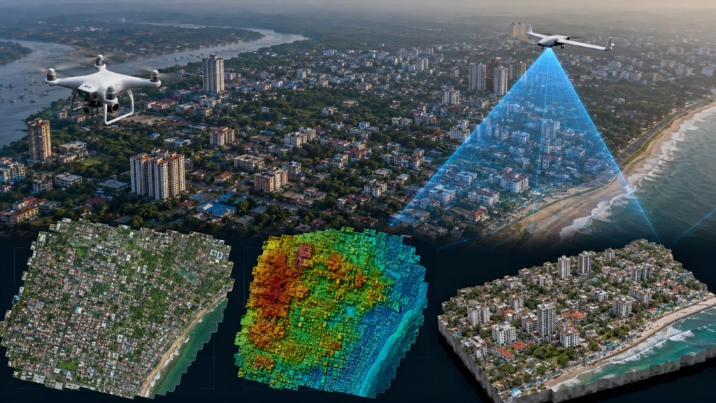
Smart City · 3D Modelling · Drone
Mangalore Smart City Ltd · Mangaluru, Karnataka · 20 sq. km · 2021
Drone survey and DGPS control producing ORI, DSM/DTM, contours, and 3D reality mesh models with building feature extraction to support Smart City planning and infrastructure documentation.
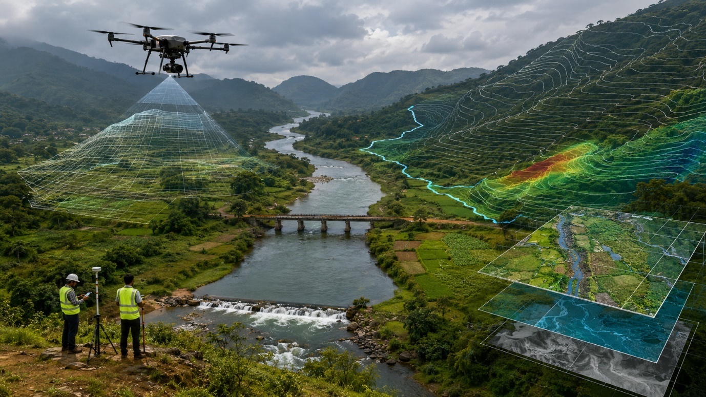
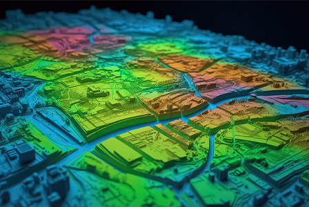
River Catchment Rejuvenation Survey

River Rejuvenation · Catchment ·
Drone
Cauvery Neeravari Nigama Ltd · Kushalnagar, Kodagu · 417 sq. km · 2023
Aerial survey across a 417 sq. km catchment generating ORI, DEM/DSM, 3D mesh, and topographic maps to plan Harangi river rejuvenation and protection works.
National Digital Basemap Production
Digital Basemap · Photogrammetry · Topography
NAPR, Georgia · Western Georgia · 3,000 sq. km · 2022–2023
A specification-compliant digital basemap covering 3,000 sq. km — photogrammetric feature extraction, planimetric mapping, topology correction, and rigorous QC for national land administration.
High-Speed Photogrammetry Processing

Aerial imagery processed into dense point cloud, orthomosaic, and DSM/DTM outputs in 6 days using Agisoft Metashape, Terrasolid, and Global Mapper.
Mobile LiDAR 3D As-Built Topography
Mobile LiDAR and panoramic imagery producing high-accuracy 3D topographic drawings, 0.5 m contour maps, and GIS/CAD-ready datasets for urban planning, infrastructure design, and asset inventory.
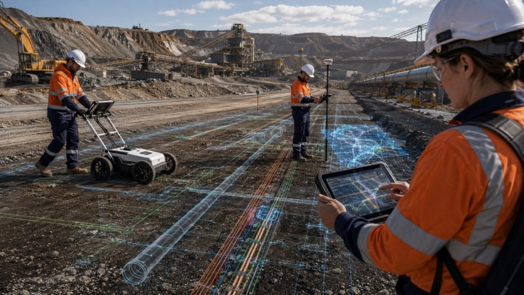
Utility Investigation Survey Deliverables
Utility Mapping · CAD · GPRUtility Mapping · CAD · GPR
Buma Mine Site, Queensland, Australia
Standardized CAD and PDF utility deliverables integrating GPR and as-constructed data — corrected linework, depth and quality-level annotations, and submission-ready outputs.
LOD 300 As-Built BIM, Industrial Port
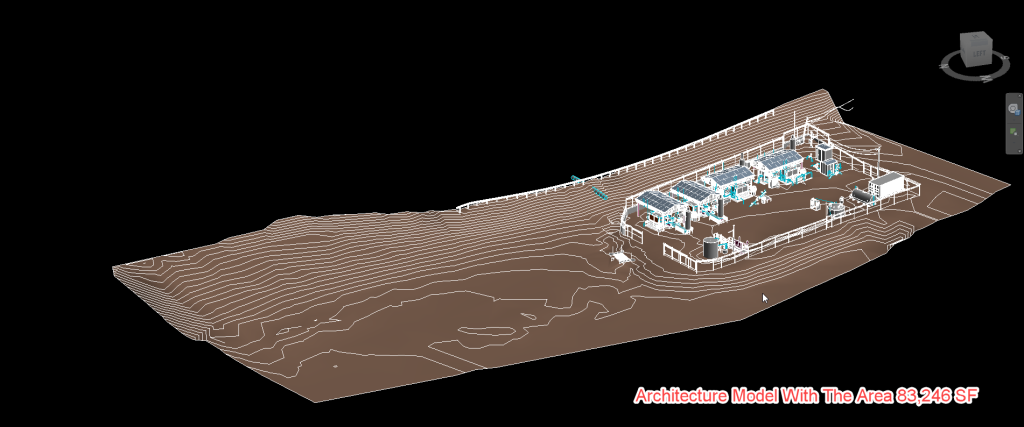
Scan-to-BIM · As-Built · Industrial
Industrial Port Facility · Portugal · 83,246 sq. ft ·
7 business days
A coordinated Architectural, Structural & MEP Revit model built from point-cloud scan data in just 7 days — supporting renovation planning, steel quantity take-offs, and future expansion studies.
High-Speed Photogrammetry Processing

Aerial imagery processed into dense point cloud, orthomosaic, and DSM/DTM outputs in 6 days using Agisoft Metashape, Terrasolid, and Global Mapper.
Projects We Delivered

Aerial Photogrammetry Survey & Geo-Tagged Video Mapping

Drone Imagery Survey for National Highway Infrastructure Monitoring
Detailed Slum Boundary & Topographical Survey

Drone Survey for Smart City Mapping & 3D Visualization
Photogrammetry Image Processing for Niscemi, Italy
Digital Basemap Production for Western Georgia
Drone Survey & GIS Mapping for Harangi River Catchment Rejuvenation

LOD 300 As-Built BIM Model for Industrial Port Facility

CAD & PDF Deliverables for Utility Investigation Survey

Mobile LiDAR-Based 3D Surface Scanning for As-Built Topography
Inside Naksha Tech – Blog & Insights
Stay informed with expert articles, industry updates, and technology breakthroughs:
19 Jan 2023
How Airborne LiDAR is Shaping Future Infrastructure Projects
Discover the ultimate guide to troubleshooting common smart home issues in our latest blog post. From connectivity problems to device malfunctions, we provide step-by-step
19 Jan 2023
Digital Photogrammetry vs LiDAR: Choosing the Right Tool
Discover the ultimate guide to troubleshooting common smart home issues in our latest blog post. From connectivity problems to device malfunctions, we provide step-by-step

19 Jan 2023
The Role of GIS in Smart City Development
Discover the ultimate guide to troubleshooting common smart home issues in our latest blog post. From connectivity problems to device malfunctions, we provide step-by-step

19 Jan 2023
Mobile Mapping: Accelerating Data Collection for Urban Planning
Discover the ultimate guide to troubleshooting common smart home issues in our latest blog post. From connectivity problems to device malfunctions, we provide step-by-step
19 Jan 2023
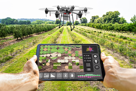
Orthophotos in Agriculture: Precision at Scale
Discover the ultimate guide to troubleshooting common smart home issues in our latest blog post. From connectivity problems to device malfunctions, we provide step-by-step
Frequently Asked Questions
Geospatial Services involve the collection, analysis, and visualization of spatial data to understand patterns, relationships, and trends. They play a key role in planning, infrastructure, land management, and environmental monitoring.
Airborne LiDAR uses laser pulses from aircraft to collect accurate elevation data over large areas quickly. It’s faster, more detailed, and better suited for inaccessible or dense terrain compared to traditional ground surveys.
Digital Photogrammetry involves extracting 3D information from 2D aerial or satellite images. It’s widely used in mapping, construction planning, and volumetric analysis for industries like mining and urban development.
GIS enables authorities to visualize, manage, and analyze spatial data, improving decision-making in zoning, utilities, disaster response, infrastructure development, and citizen services.
Mobile Mapping is used in transport planning, asset management, urban planning, utility mapping, and real estate. It allows rapid data collection from moving vehicles equipped with LiDAR, cameras, and GNSS.
Our geospatial solutions are highly accurate, with vertical and horizontal precision tailored to project needs—often within centimeters—ensuring reliable data for engineering, planning, and operational use.